
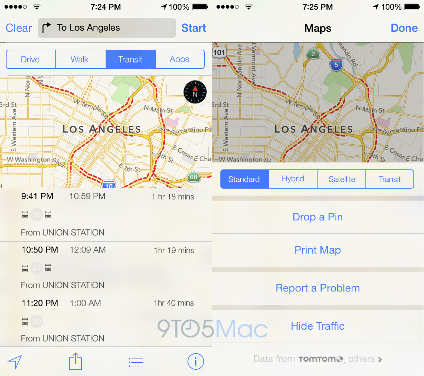
Google Maps joins Apple Maps in 3D coverage of Apple Park, but very out of date images
Apple Maps got updated with 3D satellite images of Apple Park back in March, and the same is now true of Google Maps.
Apple Maps got updated with 3D satellite images of Apple Park back in March, and the same is now true of Google Maps.


Google Maps is adding a small, but very useful feature that lets users save where they parked. Available on both iOS and Android, the feature can also provide reminders for when your parking meter is about to expire.
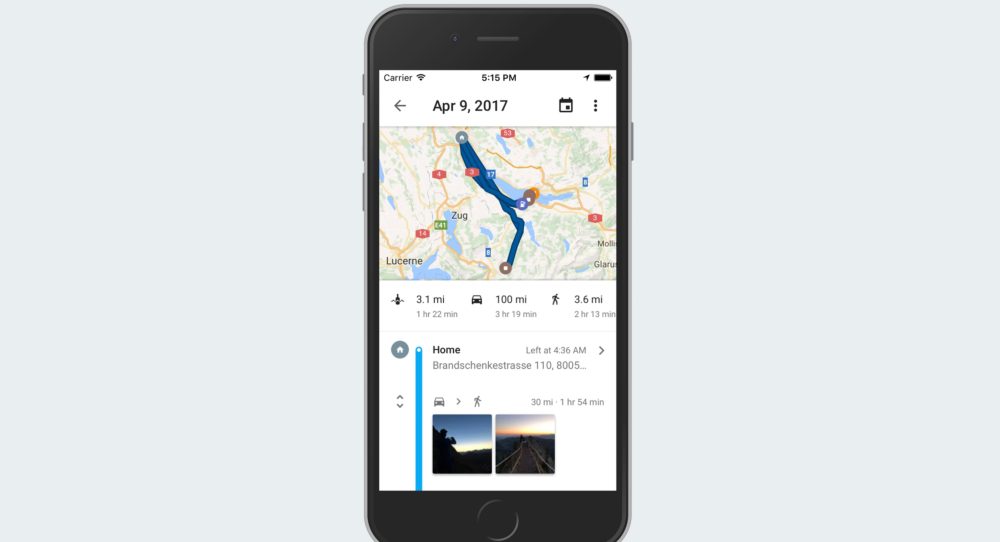
In addition to the iOS update it rolled out yesterday, Google today has announced another new feature for Google Maps on iOS. In a blog post this afternoon, Google announced the addition of a new feature called Your Timeline, which allows you to keep track of the places you visit.
Google today is rolling out an update to its Google Maps app on iOS that further integrates the app throughout the operating system. The update brings the app to version 4.30.0 and includes a pair of notable changes to the user interface as Google works to better compete with the integration offered throughout iOS by Apple Maps.
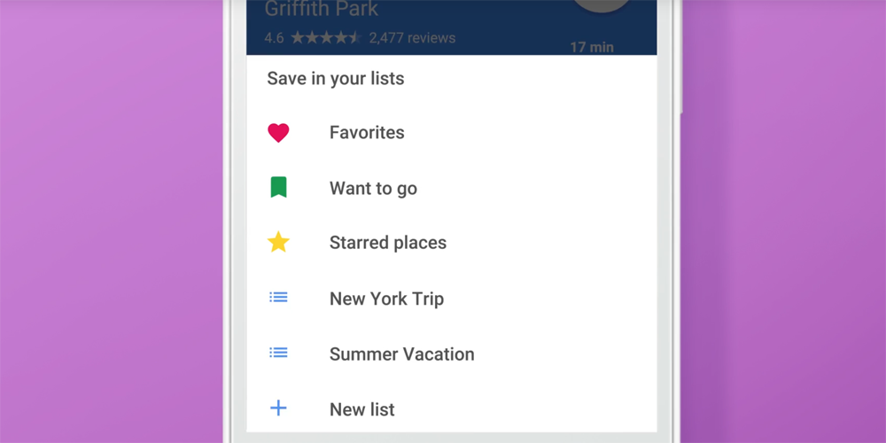
If you use Google Maps to find your way around, then an app update today makes it much easier to both plan itineraries and bookmark your favorite places. The company is today adding the ability to create lists of places you want to visit, and to share them with friends …
Google today is rolling out an update to its Google Maps on iOS that brings one of the most useful features from the web version of the app to iOS. Today’s update, which bumps the app to version 4.27, the service’s popular crowd tracker, as well as the ability to quickly access addresses saved to your clipboard.
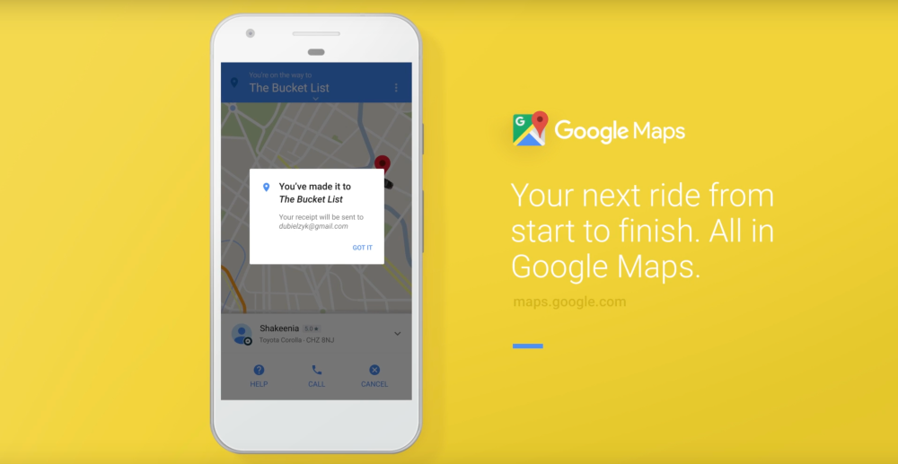
Google today has announced an update to its Maps app on iOS that brings a few notable changes. The update improves ride sharing integration with Uber, while it also refreshes the ride sharing interface as a whole. The update is also coming to Android.
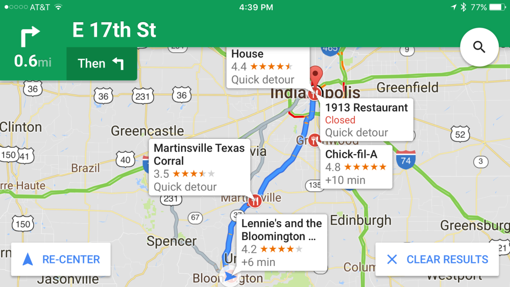
Google today is pushing a new version of Google Maps to iOS users. The update, which brings the app to version 4.25, includes a pair of new features. There’s additional optimization for iOS 10’s widget functionality, as well as a new feature that will make it considerably easier to find a place to stop off during a drive…
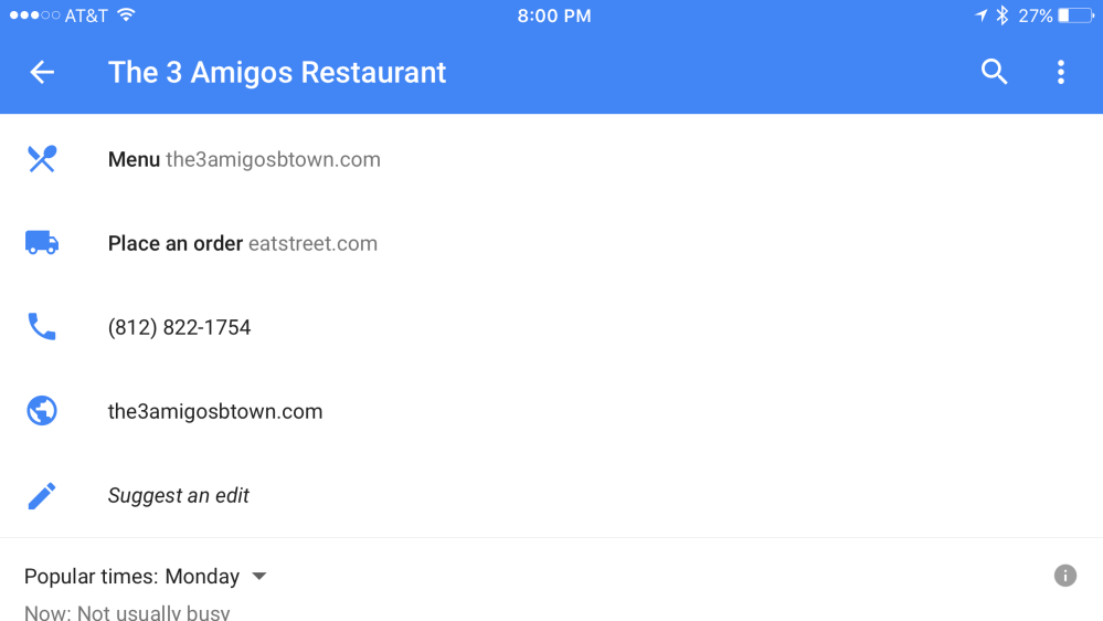
Google today is rolling out an update to Google Maps on iOS that bumps the app to version 4.24 and brings a few useful new features for users. Now, users can more quickly order food from their favorite restaurants, as well as easily add photos of places from directly within the app and find plus codes for locations around the world.
New user-interface seen on the left
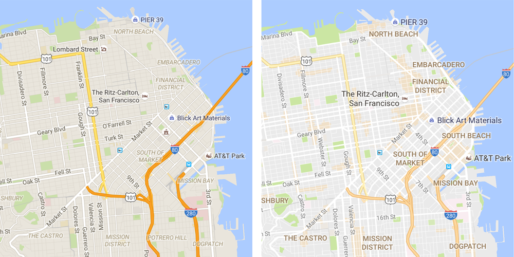
While Apple Maps got off to a rocky start, with many of us opting to use Google Maps instead, it did manage to gradually win back our confidence – with three times as many users as its Google rival by the end of last year. But Google is working hard to tempt back iOS users with an improved user-interface and a new way to highlight where the action is when visiting a new city.
The most visible difference is that many road outlines have been replaced with solid color. This small change makes a surprisingly big difference to the clarity of the maps, as seen above. But it’s the new ‘areas of interest’ feature that may provide the greatest temptation to switch apps …

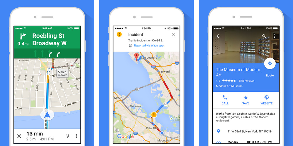
The iOS Google Maps app has long shown you Uber fares and pickup times when you search for a destination, provided that you have the Uber app installed. Google has integrated five more services into its mapping app. Most of these are for countries outside the USA – though NYC dwellers can also use Gett.
If you have a provider’s app installed and tap on the ride service tab, you’ll be able to see fare estimates and pick up times if a car is available near you. Select a service, and we’ll take you directly to their app for you to book your ride with one tap. When it makes sense, we’ll also show ride service availability when viewing the map in walking and transit directions, and multiple ride services options for each provider—where they exist. For example, if you’re using Uber, starting today, we’ll now show uberX, uberXL and UberBLACK for an easy and quick comparison.
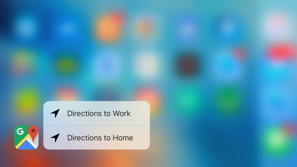
Google today has rolled out an update to Google Maps on iOS, bringing the app to version 4.16 and introducing a pair of new features. The update adds detour/pit stop support to the app, as well as adds support for 3D Touch on the iPhone 6s and iPhone 6s Plus.
Google’s Maps app for iPhone and iPad got a small but useful update on the App Store today. The latest version of the Google Maps iOS app now includes a couple of handy features.
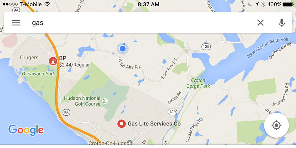
First up, and undoubtedly the most useful for drivers is the up-to-date gas prices in the US and Canada. The feature was included in the Android version of Google’s app a couple of months ago and lets users check nearby gas stations to see which has the most affordable prices. You can find prices simply be searching for ‘gas’ or ‘gas stations’ in the search field and Google Maps will automatically bring up the nearest options and list pricing for those locations.


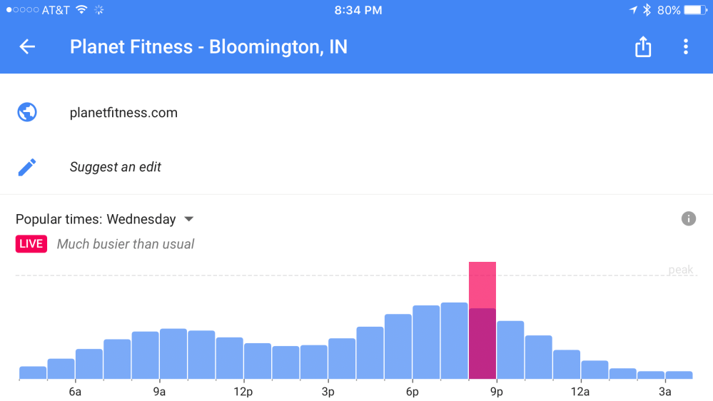
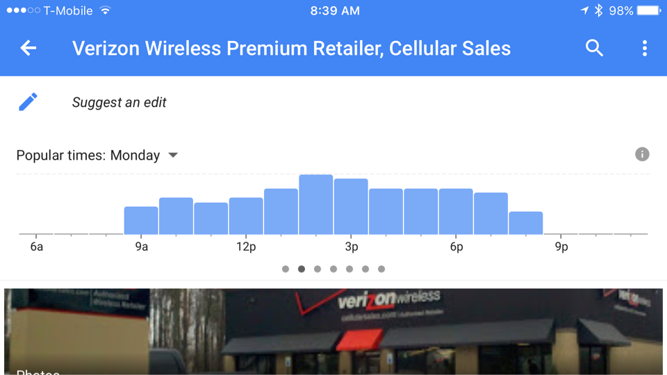
Business hours have been included in the app for some time, but today’s update also lets you check when is best to avoid/visit particular businesses. Like its online search and maps tools, the updated iPhone app brings the ability check popular visiting hours for local stores and outlets. Now you can see what you always knew about any business or retail location: It starts getting busy after lunch.
Google Maps version 4.13.0 is available to download from the App Store for free and requires users to be running iOS 7.0 or later and is compatible with iPhone, iPod touch, and iPad.

It’s no secret that when Apple Maps launched back in 2012 it had more than its fair share of issues. The issues included things like incorrect turn-by-turn directions, mislabeled landmarks, and much more. Three years later, however, Apple has been working to remedy the issues its had and according to a new report out of The Boston Globe, the improvements aren’t going unnoticed by users.
Google will soon be bringing a major new feature to its Maps app for iOS: full offline support. Google Maps has some utility already when used offline, but an upcoming update will make it much more robust when used without Internet access. For example, before you could see an area on Google Maps offline but not do much else with it. Coming soon, Google will enable features including navigation and business information lookup without requiring an active Internet connection.
Expand
Expanding
Close

Google today has rolled out an update its Maps application on iOS, bringing with it a pair of new features. The update bumps the app to version 4.12.0 and includes support for adding missing businesses to the app’s database and spoken traffic alerts.
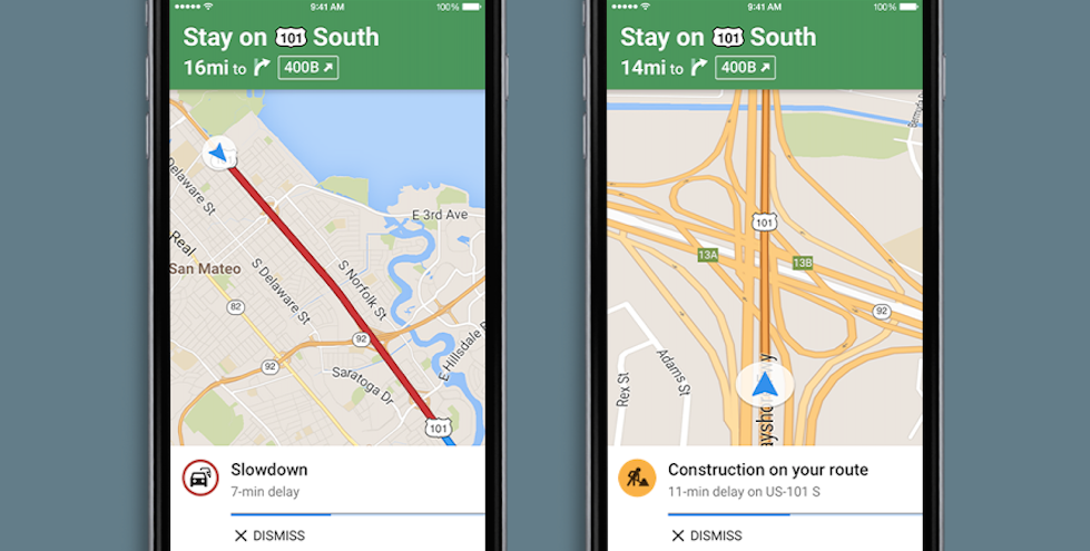
The latter of the two is the far more interesting addition of this update. Spoken traffic alerts mean that Google Maps will now alert you about upcoming traffic congestion and traffic incidents as you use the Navigation feature of the app. It does so via voice so you aren’t distracted while you drive. Traffic descriptions provide the same information, but in both text and verbal forms before you start to move.
Google Maps version 4.12.0 is available via the App Store now for free. The full changelog can be seen below:
What’s New in Version 4.12.0
- Easily add new and missing businesses from the sidebar
- Spoken traffic alerts in Navigation tell you about congestion and incidents on your route and traffic descriptions give you summary of traffic before you drive
- Bug fixes
Google has released an updated version of its mapping application for iOS that includes several new features, including an Apple Watch app. Along with the new watch app comes the ability to compare ETAs for different modes of transportation, such as biking and walking.

Google has updated its mapping app for iOS with a redesigned transit view that includes real-time information about your arrival time that previously debuted on Android. The new app also provides additional choices for alternate routes.
The update also gives you new options for sharing your maps with other users, specifically noting that Facebook and its separate Messenger app are both supported now. A gird view of photos has been added for locations, too.
You can download the free Google Maps app on the App Store for free.
What’s New in Version 4.8.0
• Redesigned and improved Transit directions improve the experience in cities, giving you more route choice and real-time arrival information where available
• Additional app options for sharing a place (including Facebook and Facebook Messenger)
• Introduced an Image Gallery for a quick visual understanding of a place through a grid view
• Bug fixes

Three years after Apple launched its own iOS Maps app to replace Google as its iPhone and iPad map provider, the Cupertino company is readying its first major enhancements to the service. While Apple was known to be gearing up for the launch of a mass transit directions service this fall in a handful of cities, sources have revealed that it is also developing its first entirely in-house mapping database to reduce its reliance on TomTom, using a fleet of mysterious vans to take still photos of business storefronts to replace Yelp photos, and building a 3D Street View feature. Apple has been using the sensor-equipped vans in cities such as Los Angeles, Dallas, and New York since earlier this year, and, below, we detail how the vehicles are advancing Apple’s plans for the future of Maps…
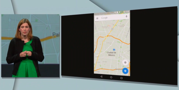
As part of its Google I/O developer conference today, Google is offering some updates on its Google Places API for iOS as well as future updates arriving for its Maps app.
Expand
Expanding
Close
While Apple plans to debut its own mass transit directions service for Maps in iOS 9 as soon as June, the rollout will not be as ambitious as some users may have hoped. In its first iteration, Apple’s Transit service will only support approximately a half-dozen cities across the United States, Canada, and Europe, in addition to China, according to sources…
Having originally planned to add a new transit directions feature to Maps last year, only to pull the feature before WWDC 2014, Apple now hopes to launch its Transit service with iOS 9, according to sources. Apple currently plans to debut bus, subway, and train route navigation as the central upgrade to the Maps app in iOS 9 at WWDC, using a user interface similar to the one intended for last fall’s launch, as depicted in the screenshots above…
 Google Maps for iPhone and iPad has received an update to version 4.4.0 bringing a new full-screen map view, improved transit directions and voice search, and the ability to filter search results for Zagat-reviewed restaurants.
Google notes that the new full-screen mode can be activated by “tapping an empty spot on the map,” while improved voice search brings the ability to “type, or tap the mic and say, “directions to” a place for faster results.”
The update also includes new transit line colors on maps when viewing transit directions and a Zagat filter for restaurants in search results.
The updated Google Maps app for iOS, version 4.4.0, is available on the App Store now.
• View a full-screen map by tapping an empty spot on the map
• See transit line colors on the map when you get transit directions
• Filter search results for Zagat-rated restaurants (where available)
• Type, or tap the mic and say, “directions to” a place for faster results
• Bug fixes
Google is packing even more useful information into the latest version of its Maps app for iOS. Google Maps 4.3.0 for iPhone and iPad adds several contextual data points to locations like nearby businesses for address searches, quick facts for notable locations, and even event information for select venues.
Expand
Expanding
Close